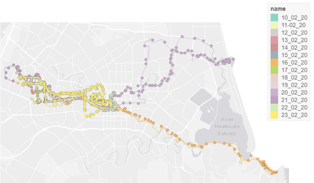
Overseas Institutional Visit
I have spent the first part of 2020 completing an Overseas Institutional Visit (OIV) to the GeoHealth Lab at the University of Canterbury in Chirstchurch, New Zealand. Funded by the ESRC, I have been conducting a project using smartphone GPS data to investgiate activity space. Looking at how different measures of activity space vary in the environmental featrues they captured and subsquently the conclusions we may draw about the influence of the enviornment on activity.